Validation against DMI ice charts
The ice charting division at DMI (Greenland Ice Service) produces in average 3-5 charts per week. Most charts cover the Cape Farewell area, but also the east and west coast of Greenland are frequently covered. The areas covered are shown as black squares in the figure below. Besides the service related to navigational charts the Greenland Ice Service produces one weekly product covering all of Greenland and usually based on navigational charts, AVHRR and MODIS data. The area covered is shown as the total area in the figure below (click at the image to enlarge).

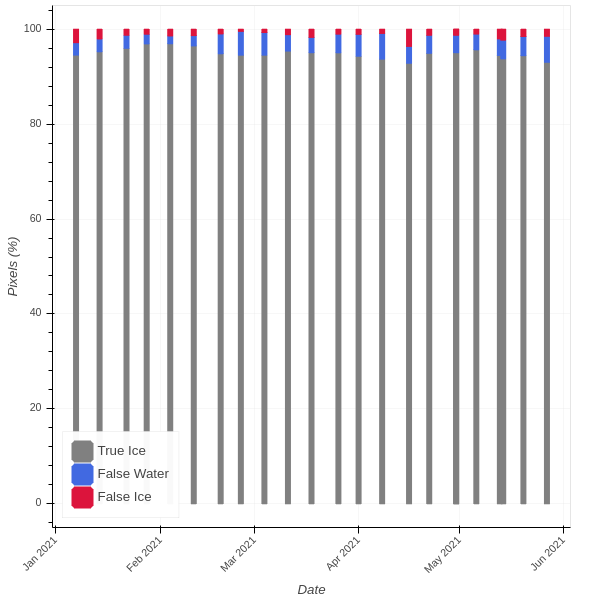
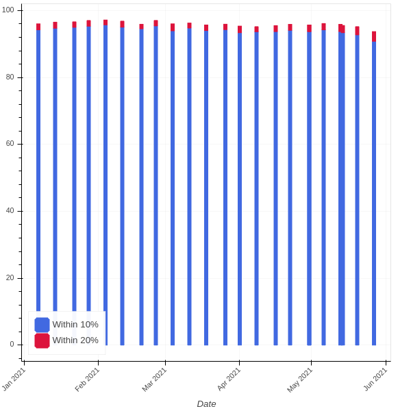
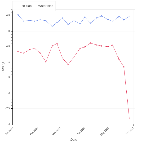
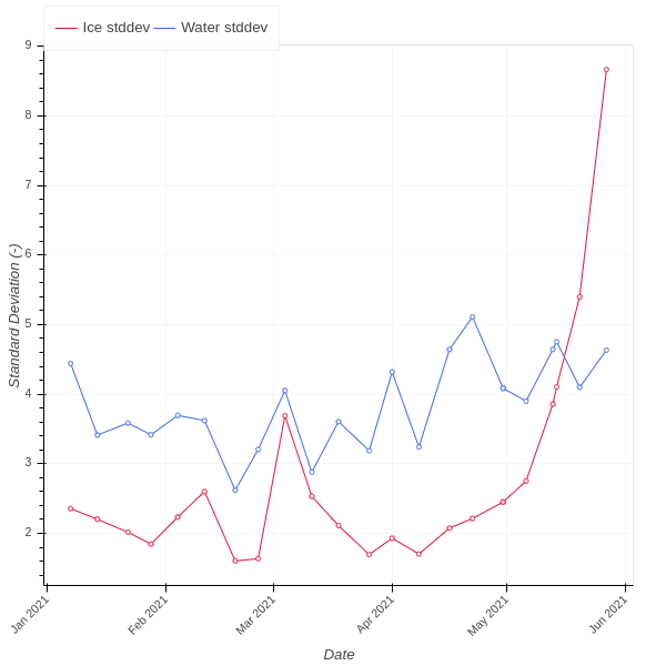
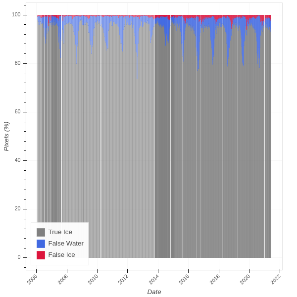
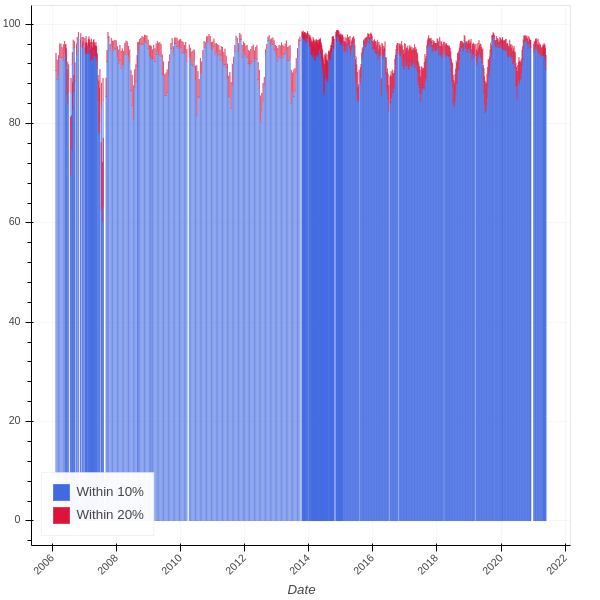
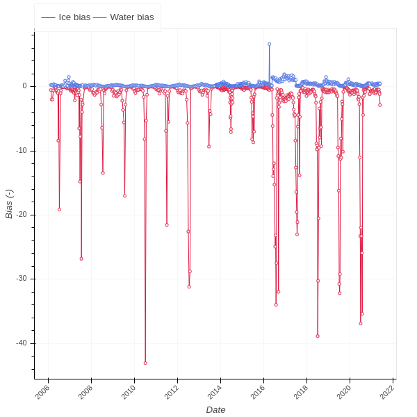
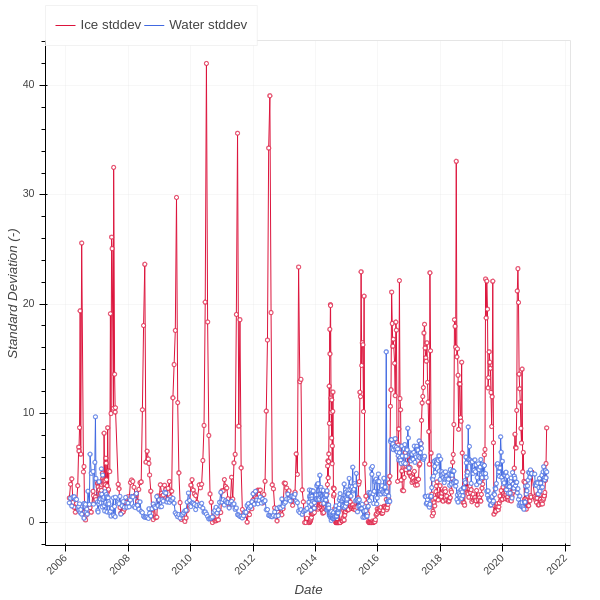
The validation is carried out as a weekly validation by means of automatic comparison of OSI SAF grid with navigational ice charts for ice edge and ice concentration. The weekly ice chart and the OSI SAF product are gridded into a common projection and resolution. Following this a gridpoint by gridpoint comparison is carried out. Only gridpoints based on Radarsat high resolution data are used. For each ice chart concentration level the deviation between ice chart concentration and OSI SAF ice concentration is calculated. Afterwards deviations are grouped into categories, i.e. +/-10% and +/-20%. Furthermore the bias and standard deviation is calculated for each concentration level. The bias and standard deviation are reported for ice (> 0% ice concentration), for water (0% ice concentration) and for both ice and water as a total.
For the weekly validation the concentration product is required to have a bias and standard deviation less than 10 % ice concentration on an annual basis.
Ice edge comparison last year
Ice concentration comparison last year
Ice concentration bias last year
Ice concentration standard deviation last year
Ice edge comparison 2006 - today
Ice concentration comparison 2006 - today
Ice concentration bias 2006 - today
Ice concentration stddev 2006 - today